We are constantly experimenting with new technologies to support field surveys of complex heritage sites, especially where they are difficult to access due to plant growth, hazardous terrain or protective measures. The use of small unmanned air systems (sUAVs) or “drones” and other remotely operated devices is delivering an invaluable capability in not only the collection of data relevant to the future construction of Virtual Heritage sites, but in their subsequent visualisation, using remote AR techniques.
Longstone Manor
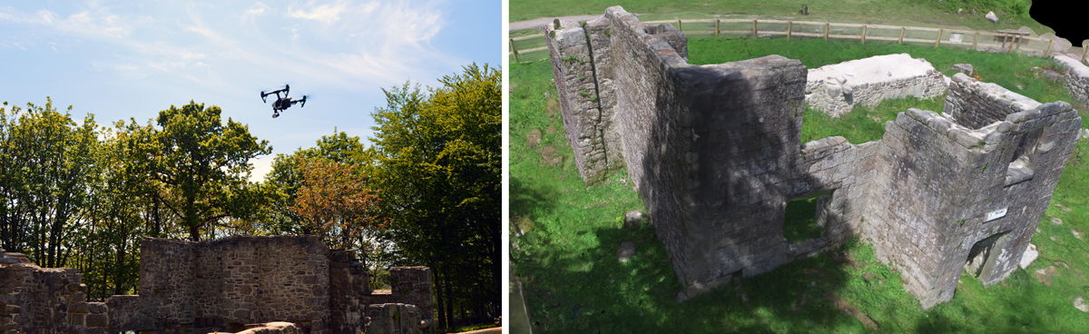
Longstone Manor was a 16th Century Manor House that was finally abandoned in the late 1800s, when Burrator Reservoir was completed. Today, all that remains are some of the main walls of the main manor house and those of adjacent buildings.
Using drone technologies has allowed us to gain overhead views of this protected site. We have have used the information gathered and the Pix4D drone mapping software mapping to support the ongoing construction of a VR representation of what the Longstone Estate may once have looked like.
Foggintor Quarry
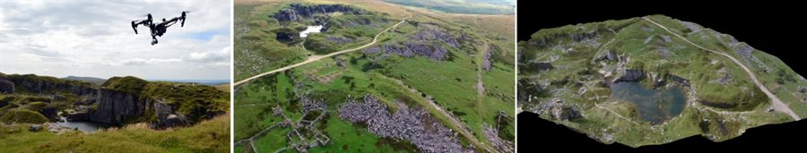
At the time, the aerial survey and subsequent 3D recreation of the historic Foggintor Quarry on Dartmoor, between Tavistock and Princetown was considered to be the biggest challenge for our DJI Inspire 1 drone.
Foggintor was one of the three great granite quarries of Dartmoor (the other being Haytor and Merrivale). Its material output being transported using the local GWR railway line connecting Princetown and Yelverton with Plymouth and the rest of the UK. During the 1840s some 300 workers were employed at the quarry, many living in specially built cottages nearby, and these included blacksmiths, carpenters, stone masons, horsemen and others.
The Pix4D reconstruction of this large site was achieved, remarkably, following a single (one-battery) drone flight lasting approximately 15 minutes.
More recently, and with the support and permission of the Dartmoor National Park Authority, we carried out a similar exercise over the long-abandoned granite quarries of Haytor, an area described by many as Dartmoor’s most famous landmark. This project, aims to recreate the quarry scenes of the 19th Century, including the famous tramway, which opened in 1820 to transport granite for the construction of London Bridge and has been described as the first “railway” in Devon (although its “rails” were built using flanged granite slabs, due to the lack of local sources of iron).
Hooe Lake (Plymouth) Wrecks
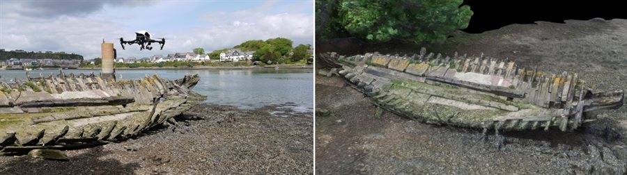
Two wrecks in particular were the focus of this particular Virtual Heritage exercise. The first involved the skeletal remains of the Arthur, a wooden “lighter” (in effect, a flat-bottomed, non-powered barge). This wreck exists, surrounded by deep mud, approximately 100m from the eastern shore of the Lake.
The 3D reconstruction of two of the wrecks was undertaken in collaboration with the Promare SHIPS organisation, partly as an exercise to evaluate a commercially available drone video data analysis package, Pix4D, and its capability to support maritime archaeological studies, especially in cases where wrecksites may be inaccessible due to treacherous mud flats or dangerous tidal conditions. In the case of the Hooe Lake exercise, a DJI Inspire 1 drone was flown over the two wrecks. The video we collected was analysed off-line a day or two after the survey, producing two very impressive 3D reconstructions.