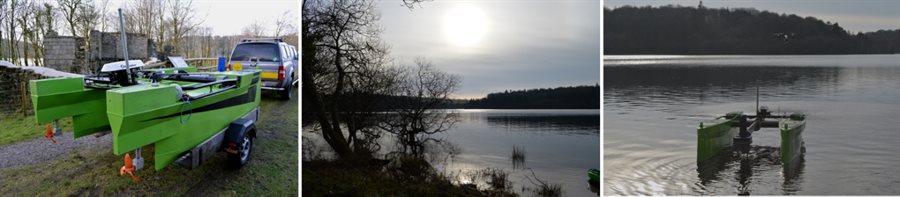
In 2016, we joined forces with Truro-based Swathe Services and Plymouth-based MSubs underwater vehicles & equipment company to undertake the first ever high-tech underwater survey of the Burrator Reservoir on the edge of Dartmoor National Park.
We used a Multi-purpose Unmanned Surface Vessel (MUSV), in effect a robot catamaran equipped with a high-definition multibeam sonar system, to conduct an autonomous survey the bed of the man-made lake in order to discover and map out a range of natural and historical features.
As well as generating a detailed virtual topography of the underwater landscape, we were able to trace man-made features that existed long before the valley was flooded in the 1890s,including the path of Drake’s Leat, the old road to Sheepstor Village over Sheepstor Bridge, Essworthy Farm, the deep scarring caused by the quarrying for stone to build the Reservoir Dam and evidence of walled areas associated with the 15th Century estate of Longstone Manor.
The results of the high-tech underwater survey were also used early in 2017 to help the Devon & Cornwall Police Diving Team in their search for a missing 30-year-old man. Screen grabs of the virtual search areas were provided to the Police in order to provide the divers with an appreciation of the underwater environment and any obstacles or deep gullies they may encounter during the dives.