Assessing the Underworld is an EPSRC-funded, multi-University, multi-disciplinary project to examine the condition of buried assets and to provide decision support tools to utility owners.
Our contribution was to measure the condition of asphalt paved areas, to detect damp areas under paved areas and to determine the extent of plant and tree roots that cause significant damage to buildings and buried utilities.
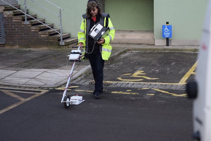
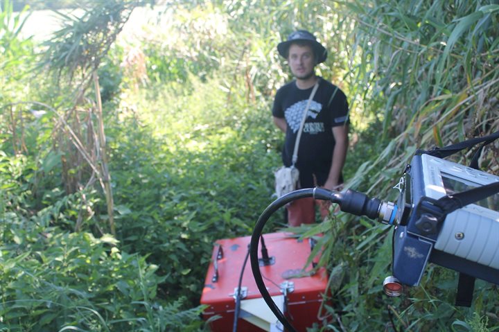
The Lead Research Fellow is Dr Farzad Hayati, who has responsibility for all areas of the project (seen here operating a 1.5 GHz ground penetrating radar).
Measuring the condition of asphalt surfaces
A key area of focus for the project is detecting the degradation in the condition of asphalt surfaces. This often implies detecting the water content in the top few centimetres of the surface and significant water content in the base layers. Ting Yan (featured below) is responsible for developing the underlying science associated with non-contact, low-frequency electromagnetic measurement of the water content.
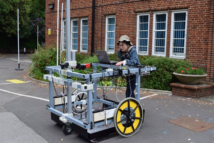
Farzad and Ting have developed an automatic vehicle that can step-and-repeat electromagnetic measurements under field conditions. This saves hours of back-breaking manual work.
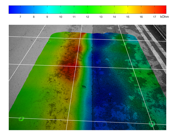
The fused image below shows the outputs of the field measurements. The red areas show a newer asphalt layer with very little water content, probably heated by an 11 kV electrical power cable. The blue areas show water ingress into 40 year old asphalt. In this case a trench has been dug to lay a cable and water is entering from the joint. Frost damage to the surface will be more likely in the blue areas.
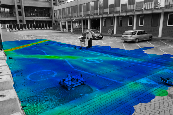
A second example of a larger area is included below. This includes a deliberately inserted V-trench. The furthest arm of the V has been reinstated to the highest standards possible and the red indicates very little water ingress. The nearest arm of the V has been re-instated to current standards but at the lowest-cost. Just noticeable is that this arm has been re-instated in three sections – but all sections have higher water ingress than the furthest arm.
Non-invasive measurement of roots
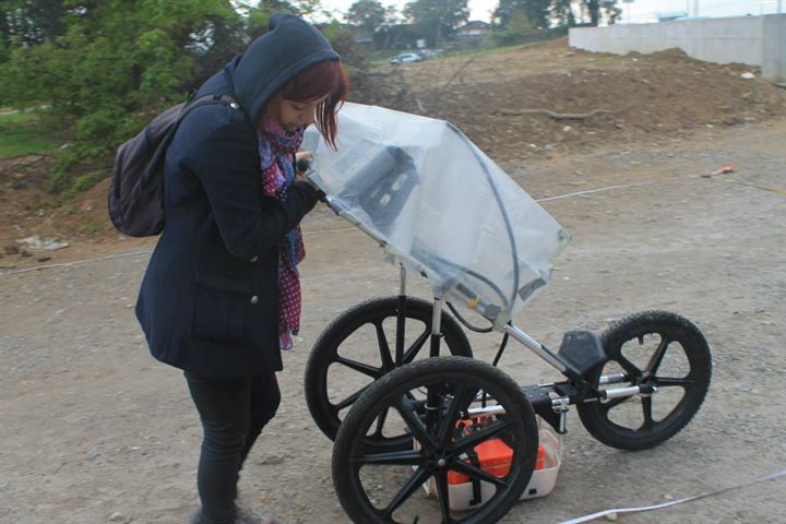
A second area of research is to remotely and non-invasively measure the root extent of commercial cash-crops where multiple plants interact. A more extensive root structure leads to greater wind resilience and thus higher yields for the farmers. Alexandra Gerea (pictured below), here seen surveying with a commercial ground penetrating radar, is developing techniques to aid the plant growers.
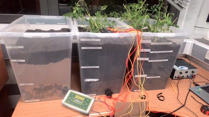
Alexandra has been developing techniques to conduct electrical resistivity tomography measurements on a very small scale. In this image, plants have been grown within the laboratory so facilitate a pleasant measurement environment.
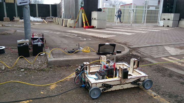
Another area of research is that of determining the tree root extent in urban areas. Politicians delight in announcing tree-planting initiative within our cities. However, these initiatives can incur a significant social cost in terms of subsidence to building and damage to pipes and sewers. Andrei Mihai (pictured below)is developing techniques and the underlying science to address this societal need. Non-contact electric and magnetic field sensors have been deployed around trees at different times of the year.
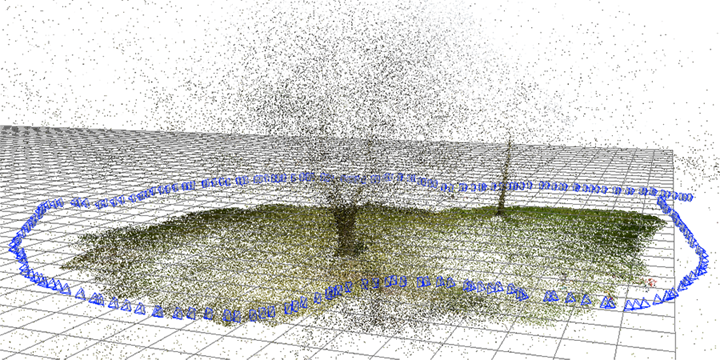
Larger-scale electrical resistivity tomography measurements have been conducted on some of the larger University trees. Farzad (pictured below) is seen here on an autumnal day.
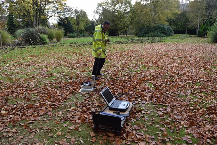
The position of the electrodes and tree canopy has been measured using photogrammetry.